Tin Can Bay

Tin Can Bay

Tin Can Bay is a tranquil village with plenty to do. Located at the southern end of the southern tip of the World Heritage listed Fraser Island. The town adjoins the great Sandy Strait and offers a sheltered paradise for birdwatching, sailing, cruising on a houseboat or fishing.

20/7 We have slowly set up camp bit by bit. We are planning to stay here for a good few weeks and need to be organised. Part of that organisation is exercise. On This trip I have taken along one of my bikes and have taken my first ride in a long time. I did only 20km, but that is better than nothing. I explored the inlets and the point of Tin Can Bay where all the boats are moored. There is even a Marina here with Chandlers and boat repair facilities.

There are some great restaurants serving good fresh seafood….

Rainbow Beach and others 003

Looks and feels tropical

Rainbow Beach and others 004

Our home for a while/

Rainbow Beach and others 011

Camp with caravan, on-suit, and annex (yet to be deployed)

Rainbow Beach and others 032

Finally some cycling

Rainbow Beach and others 009

Mangroves everywhere

Rainbow Beach and others 008

boats stranded on the mudbanks

Rainbow Beach and others 010 Rainbow Beach and others 006


During the low tide boats are resting on the mudflats. During high tide everything floats.Tin Can Boating 002

Irish Boat

Irish Boat

Tin Can Boating 005

They even have a Dragon Boat club

They even have a Dragon Boat club

Coast Guard

Coast Guard

The caravan park for boats

The caravan park for boats


Categories: 2017 - Queensland - The Fraser Coast, Travel Diary | Tags: , , , , , , , , , , | Leave a comment

Rainbow Beach

Rainbow Beach

On 19/7 we spent some time at Rainbow Beach. Situated some 25 km away from Tin Can Bay It is a vibrant beach resort that delivers on miles of sandy beaches that are patrolled by life guards. There is a Backpackers  that caters for many younger people. A few kilometres further at Inskip Point there  is a regular ferry service to the southern tip of Fraser Island. Along the way there is bush camping for many kilometres between the road and the sea.

Rainbow Beach has many shops, supermarkets, and industrial estate and other services available to the visitor. This includes horseride , Kayaking,  bushwalking and cycling. There are many surfing spots along the miles of beaches. There are several access points to the beaches where 4×4 access is allowed.


Trawler returning home

Trawler returning home

Ferry to Fraser

Ferry to Fraser

Gimme some sun I need a tan

Gimme some sun I need a tan

Rainbow Beach and others 020

Stormy waters to Frase Island

Stormy waters to Frase Island

Rainbow Beach and others 012

Categories: 2017 - Queensland - The Fraser Coast, Travel Diary | Tags: , , , , , , | Leave a comment

Getting There

Getting there

All good things come to those that wait!

We finally started our journey to get out of the Victorian winter on 15 July. After 2 months of cold temparatures and fires every evening, we headed north to a little-known place,  north of Noosa  Qld , called ‘Tin Can Bay’. We had been delayed for a few months because my dear wife had developed a heart condition that required a number of stents. This has now been done and we are now safe to travel.


On said morning we had to defrost the door locks and the windscreen before we departed. The ‘From’ temperature was 0C degrees.  The first leg took us to Narrandera in NSW. Great little town for a stopover.  We prefer stopping at the Lake Talbot caravan park as it is away from the traffic noises of the main road. It sits on a hill overlooking the lake  and has many drive through sites for caravaners. Since our last visit all drive through sites have been reconstructed and many other sites have been renovated. (see pics below.)

Neat construction and heaps of space!

Neat construction and heaps of space!

Cute homebuilt caravan

Cute homebuilt caravan

2017  QLD trip 007


After enduring a frosty night, the next day (16/7) saw us move along to Gilgandra just 65km north of Dubbo. The Newell highway was a pleasure to drive along with work continuing at improving the surface. The scenery along the road was dry and mainly boring. However,  the temp had improved a bit. Along the way we came across a Dakota. Used to jump out of these in the army/

Reno option in Gilgandra

Reno option in Gilgandra

On the road to Goondiwindi 023

I used to jump out of these in the army!

I used to jump out of these in the army!


On day 3 (17/7) we moved along to Goondiwindi in Qld. This is a lovely town on the MacIntyre river which is the catchment for the Murray Darling basin irrigation scheme. It is also the cotton and grain capital of Australia. During the day we reached a temp of 26C degrees.

On the road to Goondiwindi 014


Today 18/7 we made our way from Goondiwindi to Tin Can Bay. We travelled some 530km and completed the trip late arvo. We booked into the caravan park and then drove to the boat launching facility just in time for a pic or two. The temp is now cruising in the high 20s.

OK, after 4 days and 1820km we are here. To-morrow we will set up camp and then start exploring. Fishing is very much on the agenda; will keep you posted. The temp has been around 26 degrees each day.

Categories: 2017 - Queensland - The Fraser Coast, Travel Diary | Tags: , , , , , | Leave a comment

The long road back home (4 days travel)

The long road back home (4 days travel)


Once again I was up before sunrise, packed up and headed off. By the time I reached the Stuart highway the sun was rising and I headed south to Alice Springs. About 40 km further I saw a wondrous sight. The sun was at the back of me and I saw a bright light reflecting from the road ahead. It looked like a copper color rod lying across the road, reflecting the sun. I slowed down to get a better look thinking that somebody might have dropped part of their load.


As I got closer the color changed to bronze and I saw that this was no rod, but rather something with a ‘Z’ shape stretching across the national highway from the middle of my lane, across the white middle line,back  into my lane and across the other lane terminating in a small neck and much bigger head that was raised above the grass verge on the side of the road. It was an awesome sight of a King Brown that was around 5 meters long. Needless to say I did not stop for a pic (scared), but also swerved to avoid running over this magnificent creature.

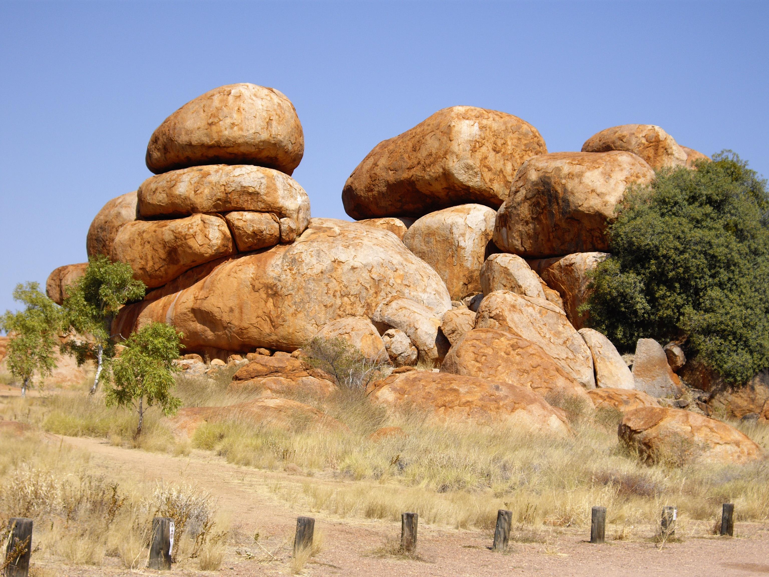
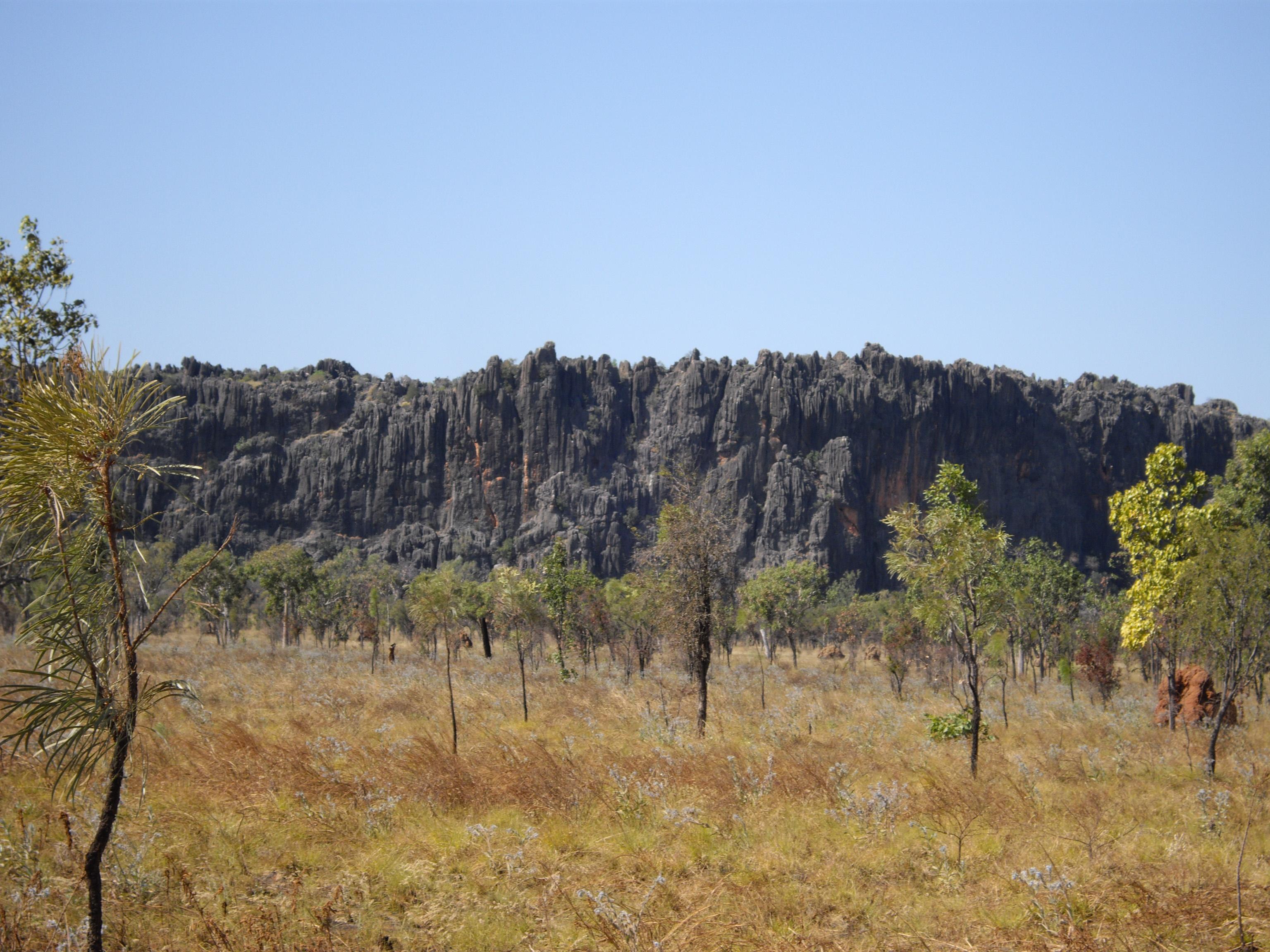
The road continued forever and south of Tennant Creek I stopped at the Devil’s Marbles. This landmark is right beside the highway.

IMGP1646 IMGP1647

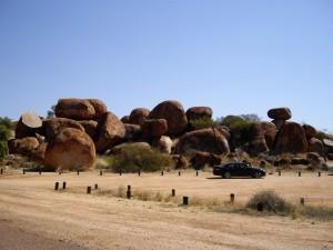
See more images at:  https://www.google.com.au/search?q=devils+marbles&biw=1366&bih=639&tbm=isch&tbo=u&source=univ&sa=X&sqi=2&ved=0CEgQ7AlqFQoTCJuIocPyhMkCFcTfpgodvyUEMw

After a short break I came across a 4wd that had rolled, the driver had fallen asleep at the wheel. That served as a reminder of the dangers of long distance driving and the need to have regular stops. I was getting very tired and eventually pulled of the road for a few hundred meters to set up camp for the night. I was an hour away from Alice Springs.


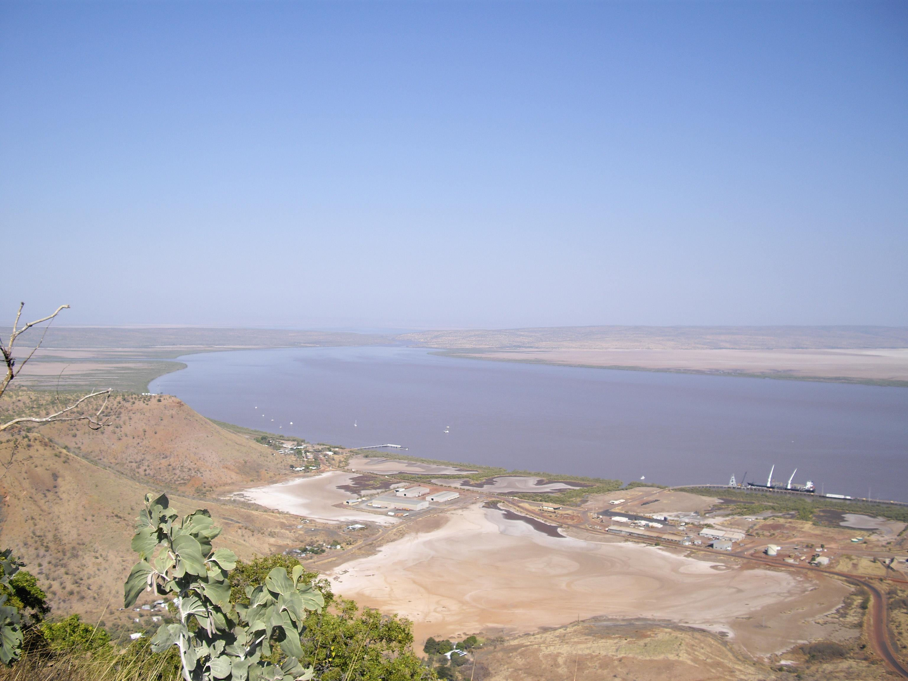
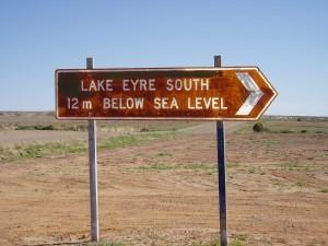
The next morning I drove through Alice and headed for Coober Pedy. Many hours later I reached Coober Pedy and refueled. 22 km south is a lesser known gravel road that turns east and reaches the famous William Creek 163 km further on. William Creek is situated on the Oodnadatta track which is one of the famous Australian outback tracks. This is also the location of the internationally famous William Creek Hotel. It is famous for its superb steaks and the fact that it is situated on Lake Eyre.  Lake Eyre in turn is famous for standing at 12 meters below sea level. There is a very basic caravan park cum camp ground.

Picture C052

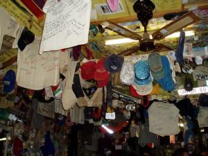
The bar and associated decorations

Picture C043 Picture C049

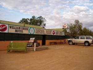
I spent an hour in the bar before enjoying a brilliant steak in the dining room. The bar had been cleaned up from the previous time I had been there.


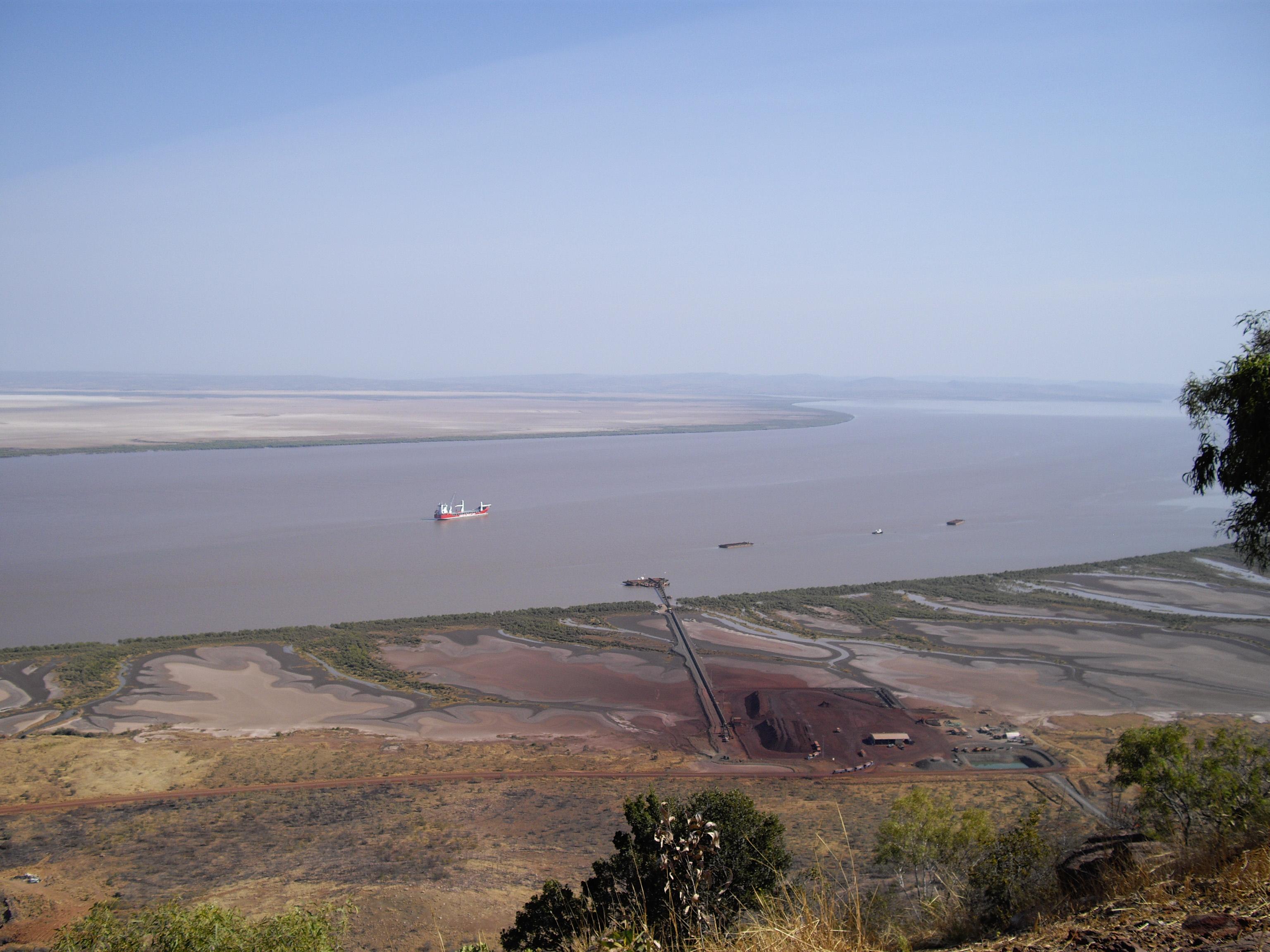
The next morning I headed south along the Oodnadatta track along lake Eyre which was sparkling as it reflected the light of the rising sun.
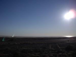
IMGP1654

Dazzling Lake Eyre

An hour or so later I turned west again on the road to Olympic Dam which is a massive BHP mine. Another 25 km or so I reached the very neat town of Roxby Downs. See https://www.google.com.au/?gws_rd=ssl#q=roxby+downs

This town had been developed for the workers at Olympic Dam.


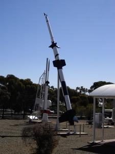
I continued towards the Stuart highway and reached the town of Woomera. This is the town where many missile tests took place in the 50s and 60s. The word ‘Woomera is from the aboriginal and means ‘spear thrower’. See my pics below.

IMGP1663 IMGP1657

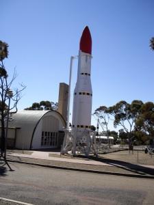
https://en.wikipedia.org/wiki/Woomera_(spear-thrower)

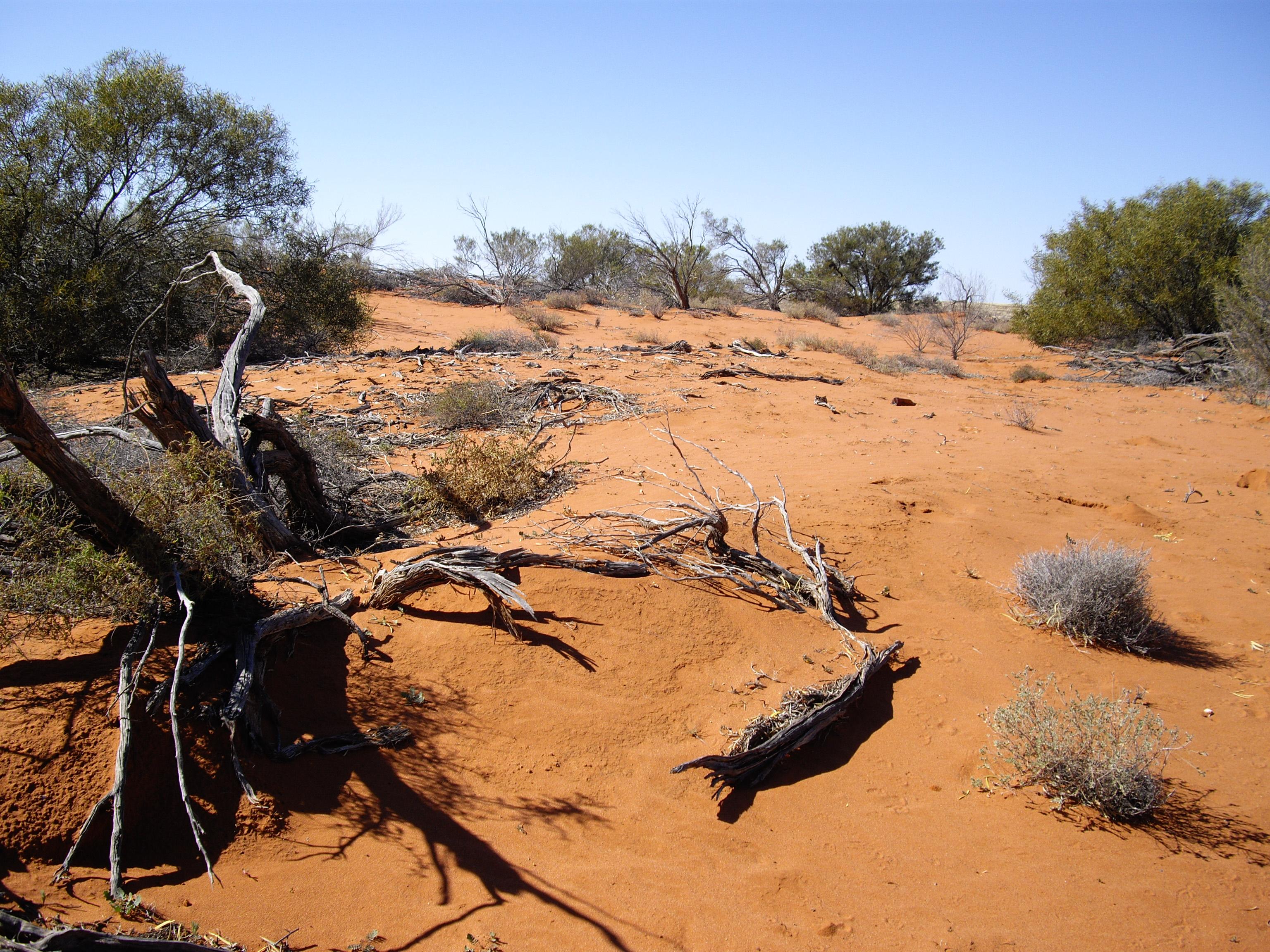
Just before I reached the highway I took the pic below as my farewell to the red dirt country.

The last of the Red Dirt

The last of the Red Dirt

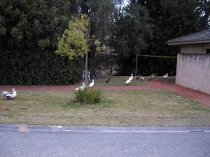
I was keen to be on my way and heading to Burra in South Australia. I had heard from a few sources that the Burra Hotel served a mighty fine fare. I had a few more hundred km to go and arrived there in the late afternoon. After settling down I was amused to see a line of geese parading along the river in the caravan park. That evening I had my meal and have to say: ‘I can vouch for the food at the Burra Hotel’.

IMGP1667

Getting Home


The next morning I set off on the last leg from Burra to the Victorian highland a trip of 810 km.

This took me 10 hours to complete including stops. After all this time it was good to be back


  • 4 Weeks  -  10500 Kilometers:
  • Home – Alice Springs – Tanami Track – Broome – Gibb River Road – Kimberley – Katherine – Home.         What a trip!!!!
Categories: 2012 Outback Trip -- North West Australia, Travel Diary | Tags: , , , , , , , , , , , , , , , , , , , | Leave a comment

Next Destination Katherine (NT)

Next Destination Katherine (NT)

I was up before daybreak, packed up the tent and headed off back to the main road. I was well on my way at daybreak. Kununarra to Katherine is 510 km.  I had heard of the beauty of the Katherine Gorge and was keen to do the day tour on offer. Katherine is a small town on the Alice to Darwin road only around 300 km from Darwin. I thought about going on to Darwin as I had never been there. However being short on time I dismissed the idea as you cannot go to Darwin only, but  HAVE to visit Litchfield and Kakadu National Parks as well. Then there is the Roper River. All of this would take another 2 weeks. So I have shelved this for another trip.

This trip was done in 2018.

Once the sun was up I could see that the landscape was sub-tropical scrub and trees, but very dry. I went cruising along until I reached the great Victoria River at Timber Creek. Earlier I passed the sign/ entrance to Bullo River Station of Sarah Henderson fame. The Victoria River is known to harbor many Salties. Would not want to swim in there for any money in the world.

IMGP1590

Victoria River

IMGP1582 IMGP1586

I reached Katherine early in the afternoon and proceeded to The Caravan Park at the Katherine River resort. The resort is situated on the banks of the Katherine river has great facilities including a huge salt water pool.

IMGP1635

The next morning I joined the Tour of the Katherine Gorge. The gorge is gorgeous (J) with steep rock walls rising on both sides of the river. In places there were sandbanks in coves that looked like secluded beaches. The tour is in three stages where rock banks terminate the cruise and passengers have to disembark and walk a few hundred yards to the next level of the river.

IMGP1620 IMGP1617 IMGP1613

Change over to next level

Change over to next level

IMGP1608 IMGP1603 IMGP1602

Along the rock walls are many places where ancient aboriginal art is visible from small pictures to 4 meter high pictures of dream time beings.

IMGP1626

IMGP1631

I have failed to mention all along this trip that everywhere I went I had a supply of water bottles. So I had a sip of water often as the temperatures were well into the thirties every day. We returned home in the late afternoon. After a hot and sweaty day I decided to take advantage of the large swimming pool for a few hours before I had a drink and cooked something to eat. The next morning it was time to head back south in the direction of home.


Categories: 2012 Outback Trip -- North West Australia, Travel Diary | Tags: , , , , , , , , , , , , , , , , | Leave a comment

Kununarra and Lake Argyle

Kununarra and Lake Argyle

The next morning I drove the 100 km from Wyndham to Kununarra dodging the large Nickel road trains that transport the ore from the mine in the Kimberley to the Wyndham harbor. The total unit has four wagons filled with more than 40 tons of ore each; a truly daunting sight when it comes thundering towards you. I slowed down every time and pulled off the road. Close to Kununarra  a long bridge fords the Ord river.

IMGP1518

I stopped at Kununarra. This is a really pleasant town with lush green vegetation, good roads and services and its own lake, Lake Kununarra. There is much fishing being done as well as boating and water skiing.

https://www.google.com.au/maps/place/Lake+Kununurra,+Kununurra+WA+6743/@-15.808885,128.7047026,13z/data=!3m1!4b1!4m2!3m1!1s0x2c998cab21689ee9:0x52f3228531800e34


Lake Argyle is a further 50 km from Kununarra. I did that in quick time as the road is all bitumen and reached the caravan park in the early afternoon. Lake Argyle has resulted from the damming of the Ord River and was built in the late 1960s. It is more than seven times the size of Sydney harbor up to the Parramatta River. The lake measures something like 45 km by 25 km. This is the largest man-made lake in Australia.


For some interesting links on Lake Argyle, see below.

http://www.lakeargyle.com/


https://en.wikipedia.org/wiki/Lake_Argyle


https://www.google.com.au/search?q=lake+argyle&biw=1366&bih=639&tbm=isch&tbo=u&source=univ&sa=X&sqi=2&ved=0CDkQsARqFQoTCNuoqOzt9sgCFYfGpgod8dkBeA&dpr=1#imgrc=cJHCTK8jFCAI3M%3Ak


It is a really great park with tall trees offering shady sites. The park has a horizon pool that is situated on a hill overlooking a section of the lake. I enjoyed walking through the park and admiring the wide variety of caravans parked there; all shapes and sizes from camper trailers to massive off road caravans.

IMGP1573

You can see forever

IMGP1578

My humble tent in the shade

IMGP1564 IMGP1562

I decided to do the Lake Argyle cruise, an all day cruise, to get to know the history and engineering feat that created this biggest manmade lake in Australia. I purchased a ticket and lined up for the cruise the next morning at the office. We were taken by bus to the boat launch which is some 4 km away.

IMGP1521 IMGP1522

Our guide introduced himself and helped us board a large catamaran, the ‘Kimberley Durack’. Once the Ord River had been dammed and the project had been completed the lake was allowed to fill up. This process of rising water levels has created more than a 100 islands. Some of them have Euros living on them. They are marsupials like Kangaroos, only smaller. They occur only in the northern regions of Australia.

IMGP1534

Miles of water and islands

IMGP1544

A Euro trapped on an island

IMGP1530 IMGP1538

Many islands are occupied by fresh water crocodiles. The islands look magnificent as the sun sets across the water. Some islands have great looking geology. In one instance the island is bespeckled with small lava pipes that look like a bunch of caves in the hillside. Many trees had Hawks, Falcons and other birds of prey sitting in them.

IMGP1528

Crocks (Freshies) are everywhere

IMGP1529IMGP1536

IMGP1540

Lava pipes

IMGP1545

In the evening our guide stopped the boat in 30 foot of water so that we might enjoy the sunset and the braver ones were invited to take a swim in the lake (amongst the Freshies).  The water was pleasantly warm. A beer and snacks were also served. We returned to our camp after sunset having enjoyed a day that most of us would never forget.

IMGP1546

The hills light up in ocher in the evening sun

IMGP1552

Categories: 2012 Outback Trip -- North West Australia, Travel Diary | Tags: , , , , , , , , , , , , , , , , , , , | Leave a comment

El Questro and their scenic spots

El Questro and their scenic spots

El Questro is a very large property on which there are many spectacular spots that tourists visit. I did not have time to take in all of them. I will cover those that I had a look at.


The next morning I continued north along the Gibb River road. There were a number of Jump Ups to be negotiated. These are climbs to the top of mountain ranges many of which seem to run east to west. The final one offered a splendid view across the next valley. One could see right across the next valley to the upper reaches of Cambridge Gulf and the town of Wyndham. This town is a Nickle ore export harbor. I could also see a number of major rivers emptying into the Gulf.


View across Cambridge Gulf to Wyndham

View across Cambridge Gulf to Wyndham

A while later I reached the turnoff to El Questro.  Another good many kilometers I reached the grounds of this tourist resort and was impressed by how well developed it was. Great caravan and camping facilities. The general visitor area is impressive as well. The general visitor cannot get to the upmarket facilities.

IMGP1455 IMGP1453 IMGP1452

After a while I carried on touring and went on to El Questro Gorge and to Zebedee Springs.Both destinations are spectacular. As I entered these gorges I could feel the air becoming warmer and more humid. It was like stepping into the sub-tropics. Palms replaced the normal vegetation and the water in the streams became clearer and warmer. Both these gorges were similar in the type of rock and vegetation. It was close to two km up the gorge to get to the spring. Many people were doing the same thing. The water at the spring came bubbling out of the rocks and measured 32 degrees Centigrade. The natural rock formations have created a number of pools where tourists enjoy a natural spa bath.

IMGP1458

El Questro tour bus crossing the Pentecost River

IMGP1465

Clear water

IMGP1463

Start of Zebedee Springs gorge

Start of Zebedee Springs gorge

IMGP1468

Tropical climate, palms and stream with deep pools

IMGP1482

The water comes out the ground at 32C.

IMGP1481

Nothing like a swim!

IMGP1474 IMGP1480

On the return trip I had to negotiate the Pentecost River once more. That got the adrenaline going as the water was touching the top of the bonnet and I did not have a snorkel on my Patrol. I was aware that if the vehicle stopped I would have to wade through chest high water that was the home to many crocks.

IMGP1476

Pentecost River, wider than 50 meters

IMGP1479

Somewhere in there Crocks are lurking

IMGP1478

Just across the Gibb river road is the turn off for Emma Gorge. This place is sensational. After walking half an hour up a hot canyon I reached this great pool that has a river trickling down an escarpment. The icy water is very refreshing and most people have a swim before heading back.

IMGP1491

Canyon walls closing in

IMGP1489

Petrified river bed; see the ripples on what was sand once

IMGP1500

Yours truly having a swim

IMGP1488 IMGP1499I returned to the Gibb River road and completed the last section to the Kununurra – Wyndham road. I decided to spend the night at the Wyndham caravan park which offers shady sites and clean facilities. Wyndham is located on the Cambridge Gulf. It has a large Nickle ore loading facility.

IMGP1505

Wyndham ore loading facility.

IMGP1506

Cambridge Gulf

Categories: 2012 Outback Trip -- North West Australia, Travel Diary | Tags: , , , , , , , , , , , , , , , , , , , , , | 1 Comment

Making progress along Gibb River road.

Making progress along Gibb River road. I took off early the next morning; there was a lot of ground to be covered. The road got steadily worse and uneven. Shortly I arrived at the ‘Queen Victoria Head’ landmark. This is a hill right next to the road that looks remarkably like the head of Queen Victoria. It looks as if someone has carved it to be like this. Problem is that it has looked like this for millions of years; see pics.

IMGP1420

Queen Victoria Head

IMGP1418 The road is getting rougher with more bends and steep climbs to be negotiated in the process of getting through a raft of mountain ranges and spectacular hills. Every now and then one comes across random bush fires that burn out of control. It seems that aboriginals still light fires to burn off the scrub for the next season. IMGP1258 IMGP1440 Every time one crosses hills, the mountain ranges and valleys are visible for many miles ahead. This serves as a reminder that the Kimberley is definitely not a flat country. A good few rivers are to be crossed; I would not want to do this in the wet season. The road would be unnavigable. Once in a while a road train has to be dodged so one has to drive with care.

IMGP1427

Heaps of mountain ranges

IMGP1438

What a rock wall!

IMGP1444 IMGP1421 A few hundred clicks further is the Mt. Barnett Roadhouse. This serves as a ‘half way house’ as there is a store and fuel is available.  They cater for overnighting of various sorts. Another good distance further is the turn-off to Kalumburu. The Gibb River road makes a right hand turn and continues to El Questro. The road to Kalumburu is very bad and rough. However it takes in the Drysedale River, Drysedale station, Mitchell plateau and falls. Kalumburu itself is some distance from the coast where you will find the scenic Honeymoon bay. I decided to give this fantastic area a miss and leave it for another trip because of time constraints. Several times I left the road to pursue tracks and explore the country side. There are many gorges in this country, some of which are very deep. Some of the rivers that are crossed have very long pools that just invite one for a swim to cool off from the heat. It is then that I remembered the Salties and so turned up the air condition instead. As a rule nobody drives at night in the Outback. It is too dangerous. No cattle properties are fenced around the road and the cattle roam freely. By the late afternoon I pulled off the road and set up camp next to a river. Some other weary travelers joined me and once again turned in for a well-deserved rest after a day’s travel and a fire.

IMGP1433

Deep rock walls down to the river in the chasm

IMGP1429

If you follow the rift it looks as if the land has been ripped apart

IMGP1441 IMGP1442

Categories: 2012 Outback Trip -- North West Australia, Travel Diary | Tags: , , , , , , , , , , , , , , , | Leave a comment

The Gibb River road – The Leopold Downs road

The Gibb River road  -  The Leopold Downs road

http://www.about-australia.com/attractions/boab-prison-tree/

Almost in Derby I reached the turnoff to the Gibb River road. Just short of the Gibb River road turnoff is a picnic area and a fenced off section with a Boab tree with a very large trunk that has been hollowed out by the weather. It is many hundreds of years old and was used in the old British days a s a local prison where miscreants were held by police until they could be transported to a prison.

See the link above.


Windjana Gorge

I started off along the Gibb River road and was surprised that it is a bitumen road to start off or very well maintained and graded red dirt road. All over the place one can see big Boab trees that add something special to the local scenery. I was heading to the turnoff of the Leopold Downs road, the route to two very remarkable sites.

IMGP1372

Dreamtime like spindly arms of a Boab; making it look like a night time ghost.

I intended going down this road to visit Windjana Gorge and Tunnel Creek. This road leaves Gibb River road heading east towards Fitzroy Crossing and eventually terminates close to Kununurra in the north. It is an average gravel road, but takes in the two spectacular sites above.

Shortly after turning off I could see a dark mountain range on the horizon. I had read about this range that it was in fact a coral reef from the Devonian period some 370 million years ago. Some planet upheaval had raised this up and the reef had now petrified into hard rock. It is absolutely massive and tens of kilometers long and in parts wider than one kilometer, There are valleys between the ranges where water has carved a passage over the millennia. The sky in the Kimberley is a fantastic blue and the vegetation is sub-tropical trees and scrub.

IMGP1374

I turned into the Windjana Gorge camping area and proceeded along the path towards the massive wall of the reef. The path leads towards the mountain until a small triangle shape gap appears that takes you through the rock into the valley beyond. The path takes you along the river that is filled with some prehistoric fish and many Freshwater Crocodiles… Not the man eating Salties, but the smaller Freshies that feed on frogs and the like. A bit further the path takes you onto the dry river bed which is filled with soft white sand that looks like a great beach. Of interest are some of the side walls of the reef that still contain fossilized shells.

IMGP1377 IMGP1384 IMGP1383IMGP1385 IMGP1395 IMGP1389IMGP1394 IMGP1390 IMGP1391


Tunnel Creek

I left the gorge and travelled another 20 km to get to Tunnel Creek. It is named so as there is a river that has tunneled a passage way under and through the coral reef/ mountains from one side of the reef to the other. The tunnel is around 700 meters long and pitch dark. You need a good torch to get from one end to the other. You have to wade through the river up to waist high in ice cold water and there are Freshies that live there.


When I stuck my foot in I did not know how deep it was going to get. It was cold and I thought ‘no, bugger that’. As I was about to chicken out I saw a light approaching from the other side. It turned out to be a 12 year old boy and his skinny mother that had done the trip and returned. Well, they shamed me into doing the trip into the unknown.


12 year old boy and mother exploring

12 year old boy and mother exploring

As you approach the entrance to Tunnel Creek you walk around some massive rocks and then enter through a triangular opening. Next thing you know you are in the tunnel which at this point has a huge vaulted ceiling that stretches off into the dark distance. You are walking on dry river sand that suddenly is replaced by water that is cold and waist deep. Bring along a good bright torch as this is the only light around. About one third of the distance in, the roof has collapsed on the side and the light shows the opening where bats are hanging in the dark corners. You can see the vegetation on top of the reef as you look up the valley from the point of collapse.

IMGP1398

Looking back to the entrance

Looking back to the entrance

IMGP1406 IMGP1407

I turned back into the dark and headed through the rest of the tunnel. Just after the half way point it makes a left turn and then heads for the exit. This is visible from far away. The exit is beautifully structures by the natural forces. At the exit one looks into a pretty valley and river which is located on the other side of the mountain. See pics.


Exit

Exit

IMGP1414

I returned the way I had come and drove back to the Gibb River road. By then it was getting late . So I set up camp next to the Lennard River some 50 meters from the road. I enjoyed a peaceful evening before turning in.

Categories: 2012 Outback Trip -- North West Australia, Travel Diary | Tags: , , , , , , , , , , , , , , , , , , , | 1 Comment

Fitzroy River and the Gibb River Road

Fitzroy River and the Gibb River Road

 Fitzroy River


It was time to leave  Broome and say goodbye to my friends. The next morning, after a coffee I hit the road north into the Kimberley. Rugged country, tough country that is what I was expecting. Beautiful and stunning country that is what I got.


Some 140 km north of Broome there is a turn off that leads to the lower reaches of the Fitzroy River. There are no signs at the turnoff except for the Boab trees (baobab in Africa). The road quickly turns into a track that goes on forever.  Eventually one reaches the banks of the river. It is wide, especially at high tide. You can see the course of the river for a few kilometers. There are a good few tents and caravans camped in the bush on the banks of the river as the insiders know that this is a killer Barramundi spot. The place is littered with massive Boab trees and it is dead quiet here; very relaxing. There are heaps of big crocks in the river as well. Luckily the bank along the river is very high.

IMGP1355 IMGP1356 IMGP1357

The land is privately owned/leased and there are many mobs of Brahman cattle running around so you have to be careful on the tracks as the Brahmans loom over your vehicle and do not always get out of the way.

IMGP1358

Fitzroy river

IMGP1359

The tracks follow the river bank for miles. I did carry on towards the mouth of the river and eventually found a great camping spot under some trees where I could set up my camp and roll out my swag. Conditions were perfect for open air camping. Had a look around the general area and as the pics will show, the river banks alternated with grassy areas and treed sections where one could find shade and shelter…and ants and other surprises. Read on.

IMGP1365

Home sweet home (:-))

IMGP1363 IMGP1364

I walked around and found a few fishing spots. Finding firewood was a bit harder as it was late in the season and much wood had been harvested already. I made a fire, cooked some food and turned in. I was getting comfortable in the dark but it was very humid so I stuck my one leg out from under the sheet. I was just falling asleep when I heard and felt that ‘plop’ as something wet and cold attached itself to my leg that was resting in the fresh air. It felt like something slimy had sucked it self onto my leg. Not one to panic I Reached out for the torch (I never sleep in the bush without a bright torch and heavy stick next to  my bed). As the light switched on I saw the two eyes of a green Australian frog look at me from my leg; see pic. He left me and continued hopping around the camp for the rest of the night. Talk about strange sleeping partners.

IMGP1369

My sleeping mate!


Several hours later I was woken up by the snorting and hoof thumping of a mob of Brahman cattle. Turns out I had set up camp on the trail for their nightly migration along the river bank. They were about to walk over me when the camp smell and the car spooked them. Once again my torch saved me. I switched on the bright light in the middle of the night and that shocked them and spooked them. They turned and fled as one.


I got up early and did some exploring and fishing for the mighty Barra. After losing most of my lures I eventually caught a decent size Barry on a crappy old lure I had purchased at Kmart for less than $4 some years ago. I apologise for the bad pic, but just to make sure I did catch & land one Barra.

IMGP1361

I need to explain that I ate very well as I have a 40ltr car fridge that allows me to carry milk and meat etc for days without spoiling. The fish was tied to a tree branch with some rope and within an hour the ants had found it and had navigated to the fish via tree n\and rope, I had to wash them all off and store the fish in the fridge.

After another brilliant evening in the bush I departed early the next morning. I planned to get back to the main road to Derby and head for the Gibb River road. This iconic outback road heads north a few kilometers outside Derby.

Categories: 2012 Outback Trip -- North West Australia, Travel Diary | Tags: , , , , , , , , , , , , , , , , , , | Leave a comment